INSURANCE DECISION ANALYTICS

Underwriting Intelligence

Powered by InsitePro®, Intermap’s property risk intelligence platform for underwriting, portfolio analysis and natural hazard risk assessment across North America

Decision-Ready Intelligence for Underwriting

InsitePro® helps insurers understand, quantify and manage natural hazard risk with greater accuracy and confidence. Powered by proprietary 3D data, AI/ML analytics and advanced geospatial intelligence, the platform delivers actionable intelligence that supports underwriting, portfolio management, catastrophe risk assessment and risk selection.

From individual properties to enterprise-wide portfolios, InsitePro® helps insurers make faster, more informed decisions while improving risk segmentation and portfolio performance.

InistePro Image 2-3-1

Built for Modern Underwriting

InsitePro® transforms complex location, terrain and hazard data into decision-ready intelligence.

InsitePro Images-1

Property-Level Risk Intelligence
Evaluate natural hazard risk at the individual property level with address-specific analytics that provide a more complete understanding of exposure.

Portfolio Analytics
Assess concentrations of risk, evaluate accumulations and support portfolio optimization across regions and lines of business.

Catastrophe Risk Assessment
Support underwriting and reinsurance decisions through consistent evaluation of flood, wildfire and other natural hazards.

Custom Risk Scoring
Build risk scoring models that align with your organization's underwriting philosophy, loss experience and business objectives.

Proprietary 3D Data. Better Decisions.

Every risk assessment begins with trusted data.

InsitePro® is powered by Intermap's proprietary NEXTMap® 3D elevation data, providing significantly greater accuracy and consistency than many commonly used public datasets.

High-Resolution 3D Data
Authoritative elevation data designed to support flood analysis and natural hazard assessment.

Hydro-Enforced Terrain Models
Terrain models optimized to accurately represent water flow, drainage networks and flood behavior.

Consistent National Coverage
Reliable data across the continental United States supports more consistent underwriting decisions and portfolio analysis.

A Better Foundation for Risk Intelligence
More accurate data enables more accurate risk assessments, underwriting decisions and portfolio outcomes.

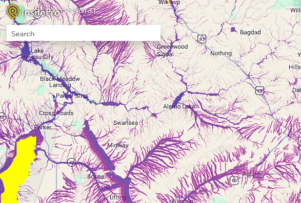
insite pro screenshot-1

Enterprise Applications & APIs

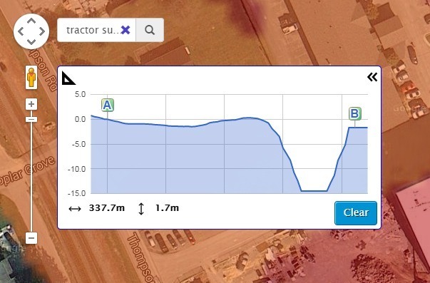
InsitePro® integrates directly into underwriting and risk management workflows through APIs and enterprise applications.

Organizations can deliver property-level natural hazard intelligence into underwriting platforms, policy administration systems and enterprise risk management environments, helping teams access decision-ready intelligence where they work.

2014-11_InsitePro_Tractor_Supply_Terrain_Profile_Measuring_Tool-1

Seamless Integration
Integrate natural hazard intelligence into existing operational workflows.

Scalable Delivery
Support individual property assessments, portfolio analysis and enterprise-wide deployments.

Faster Decisions
Provide underwriters and risk professionals with immediate access to actionable intelligence.

The Best Solutions Start with the Right Data

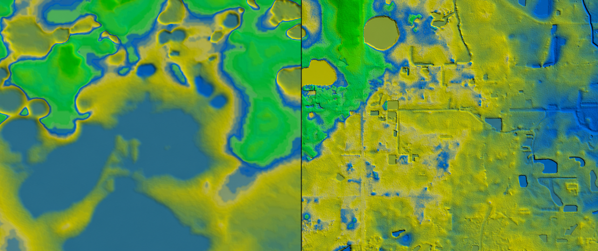
What’s the difference between their 10-meter resolution and NEXTMap® 1-meter resolution? It could be the difference between whether a property will or won’t flood.

For years, InsitePro has relied on the unparalleled accuracy of Intermap’s 5-meter NEXTMap® terrain data. We’re now introducing NEXTMap 1-meter data into the InsitePro® dataset for the continental United States.

NEXTMap® includes water flattening and hydro enforcement – one of the most important characteristics of an elevation dataset used for flood applications. Without comprehensive hydro enforcement, flood risk predictions could be flawed or misleading because you have to accurately characterize the water before you can understand where and how it will flow.

InsitePro Image

Advanced Wildfire Risk Intelligence

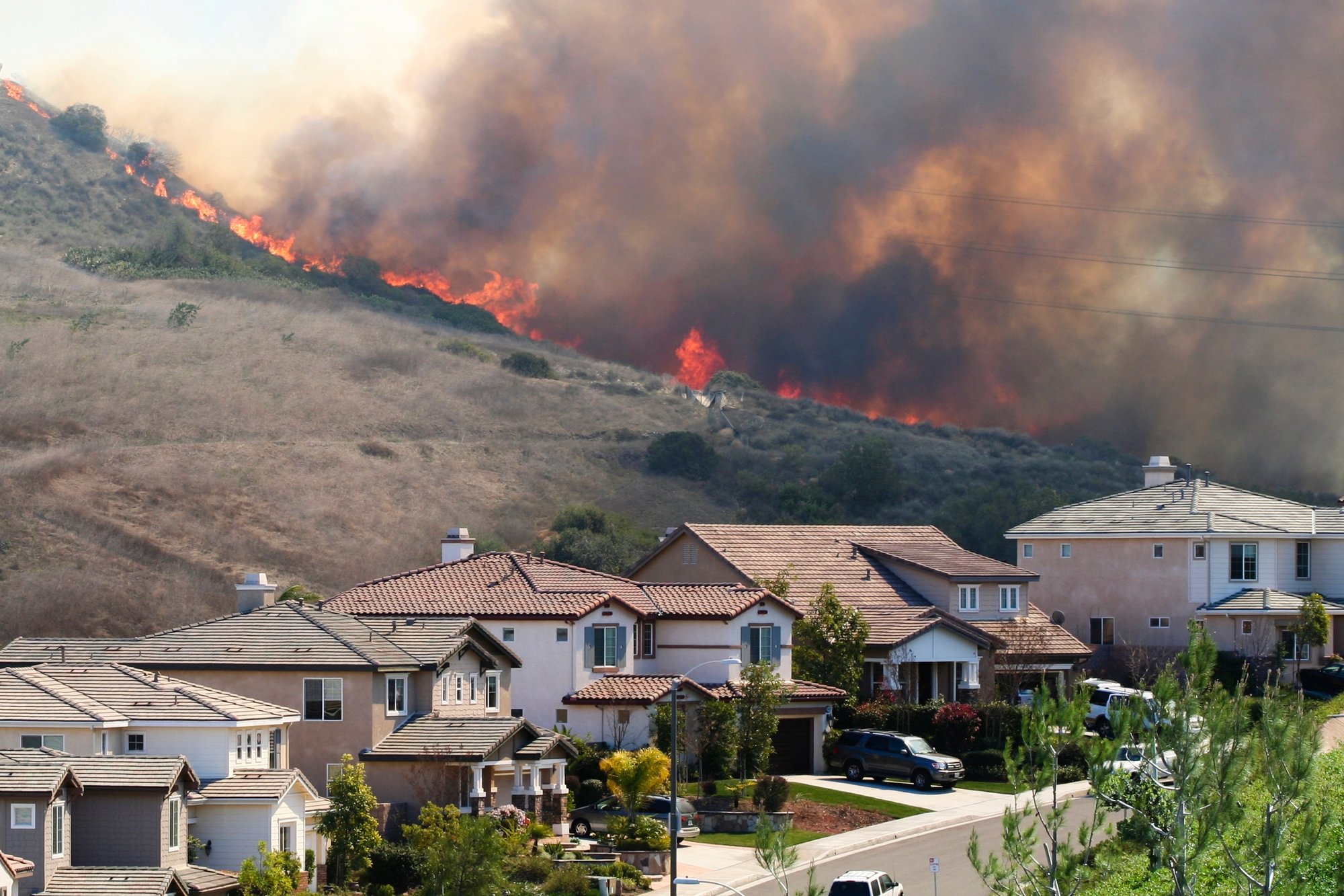
InsitePro® integrates AnchorPoint's National Hazard and Risk Model (No-HARM) to provide insurers with advanced wildfire analytics and risk intelligence.

By combining terrain characteristics, vegetation data and climatological information, the platform helps organizations understand wildfire probability, potential fire behavior and likely impacts at regional, community and property scales.

Nationwide Wildfire Intelligence
Consistent wildfire risk assessment across the United States.

Advanced Fire Behavior Modeling
Analyze fireline intensity, ember exposure and other critical wildfire characteristics.

Property & Portfolio Assessment
Understand wildfire exposure at both individual property and portfolio levels.

Risk-Based Decision Support
Incorporate wildfire intelligence directly into underwriting and portfolio management workflows.

Wildfire

AI/ML Analytics

InsitePro® combines advanced analytics, automation and geospatial intelligence to help organizations operationalize natural hazard risk information.

2017 Houston Highway Flooded small

Custom Risk Scoring
Combine proprietary underwriting information, loss history, hazard datasets and business rules to create risk scores tailored to your organization.

Portfolio Analytics
Analyze large portfolios, identify accumulations and evaluate concentrations of risk across geographic regions.

Automated Risk Assessment
Accelerate underwriting workflows with scalable analytics and decision-support capabilities.

Actionable Intelligence
Transform complex hazard and location data into actionable intelligence that supports faster, more informed decisions.

Better Flood Intelligence

Flood risk cannot be understood through flood zones alone.

InsitePro® combines proprietary 3D terrain data, hydrologic analysis and natural hazard intelligence to help insurers understand how water moves across the landscape and how individual properties may be affected during flood events.

Property-Level Analysis
Evaluate flood exposure at individual locations rather than relying solely on generalized flood zone classifications.

Multiple Flood Perils
Assess coastal, riverine and surface flooding through integrated hazard analytics and risk scoring.

Terrain Intelligence
Leverage high-resolution elevation and terrain data to better understand drainage patterns, flood pathways and property-specific vulnerabilities.

Improved Risk Selection
Support more informed underwriting decisions while identifying opportunities for profitable portfolio growth.

Flood_13

Access InsitePro®

Existing users can access their account here. 

Turn 3D data into actionable          intelligence.

Connect with our team to learn how Intermap can support your mission.