ORTHORECTIFICATION
Transform raw satellite and aerial imagery into accurate, analysis-ready intelligence with proprietary 3D data and advanced image processing
Intermap's Orthorectification Service transforms raw satellite and aerial imagery into accurate, analysis-ready products by combining production-scale processing with proprietary NEXTMap® 3D terrain data.
The result is geometrically consistent imagery that supports mapping, monitoring, analytics, AI-powered workflows and operational decision-making. By integrating authoritative 3D data with advanced image processing, Intermap helps organizations extract more value from imagery collected anywhere in the world.
Intermap delivers high-quality orthorectification services for satellite and aerial imagery collected anywhere in the world.
Accurate Geolocation
Correct terrain-related distortions and improve positional accuracy across complex environments and challenging terrain.
Multi-Sensor Support
Process imagery from optical and radar sensors through a consistent production workflow.
Multi-Vendor Consistency
Create imagery products with consistent geometry across different vendors, collection times and sensor types.
Scalable Processing
Production-grade infrastructure supports projects ranging from individual collections to national and global programs.
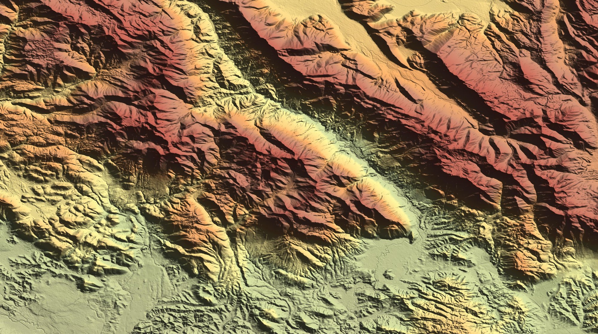
The accuracy of orthorectified imagery depends on the quality of the terrain data used to correct it.
Intermap's proprietary NEXTMap® 3D terrain models provide a more accurate representation of the physical world, helping produce imagery with superior geometric accuracy and consistency.

High-Resolution Terrain Intelligence
Leverage authoritative Digital Terrain Models (DTM) with resolutions as fine as 1 meter in select regions.
Improved Positional Accuracy
Reduce terrain-related distortions and improve image alignment.
Consistent Results
Support reliable comparison of imagery collected across different dates, sensors and providers.
Better Foundation for Analytics
More accurate imagery supports more accurate mapping, monitoring and AI-powered analysis.
SRTM vs. NEXTMap®
NEXTMap® improves orthorectification by using higher-quality elevation data to correct terrain-related distortion and produce more accurate, analysis-ready imagery.
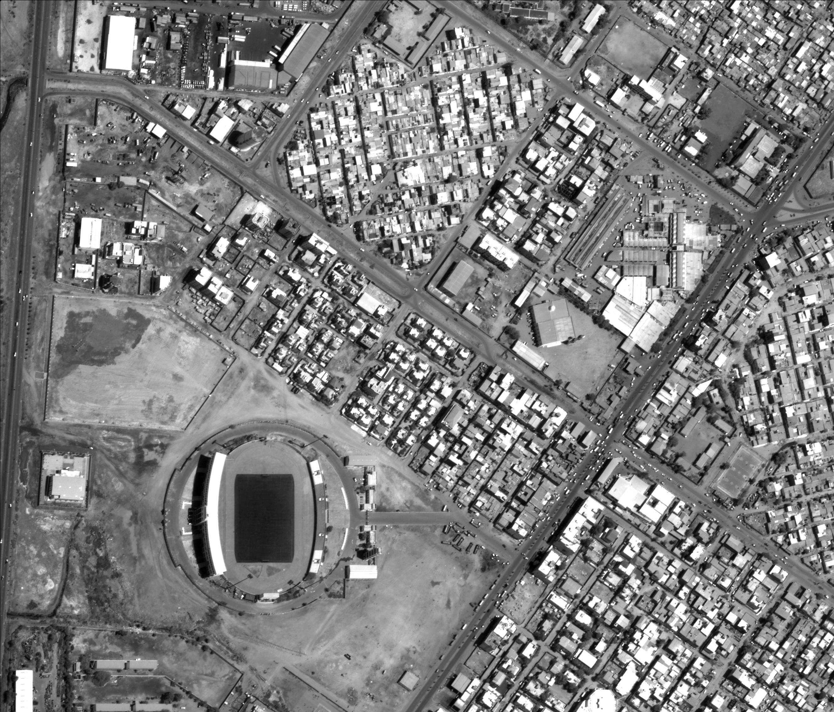
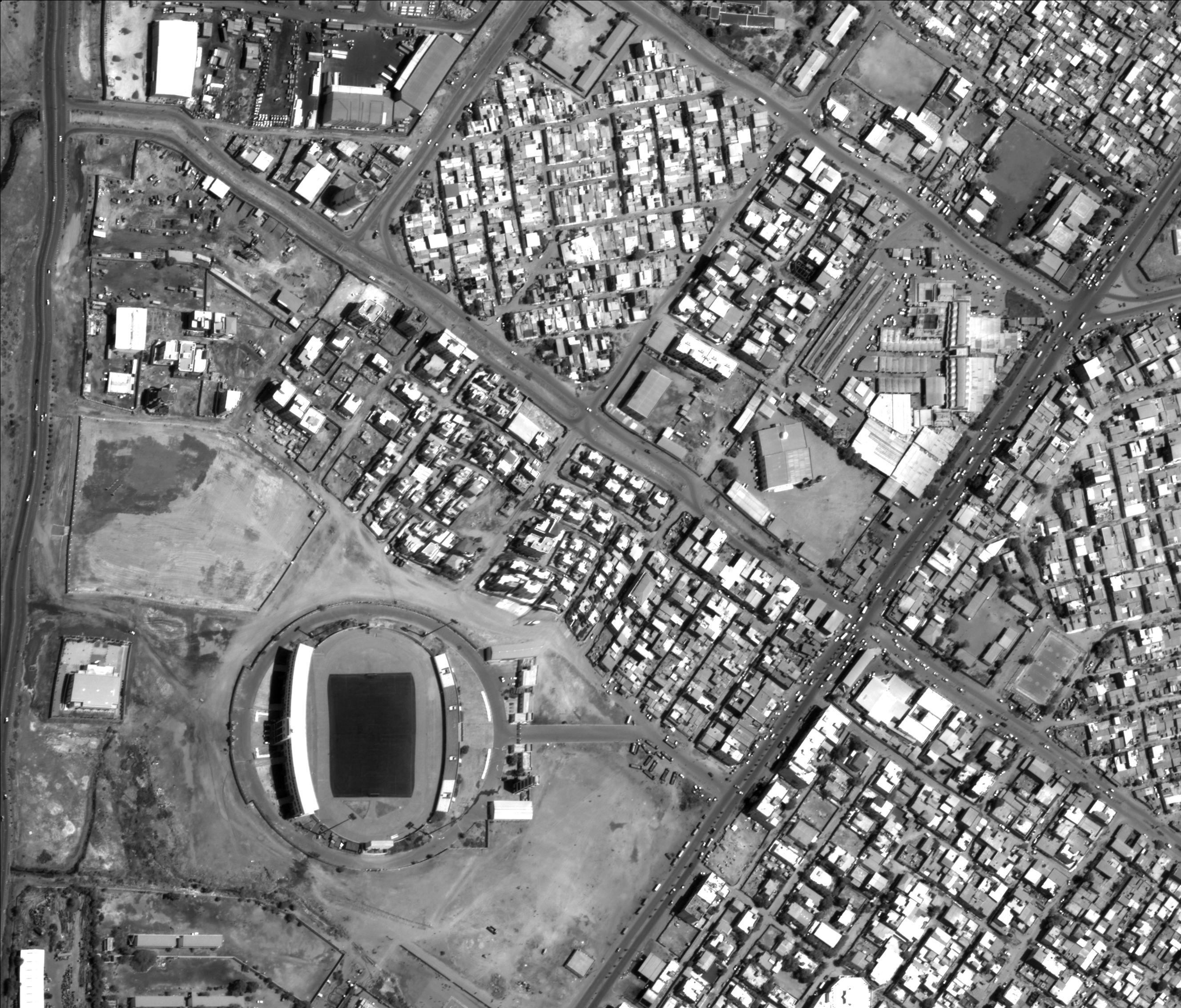
Orthorectification corrects distortions caused by terrain relief, sensor orientation, viewing geometry and other environmental factors.
Mapping & Cartography
Produce accurate maps and geospatial products.
Infrastructure Monitoring
Track changes to transportation networks, utilities and critical infrastructure.
Environmental Analysis
Monitor land use, vegetation, natural resources and environmental change.
AI/ML Analytics
Improve the quality and reliability of machine learning and automated image analysis workflows.
Multi-Temporal Analysis
Compare imagery collected over time with greater confidence and consistency.

Access Intermap’s automated orthorectification service through UP42 to transform satellite imagery into accurately positioned, analysis-ready geospatial data.
Powered by Intermap’s global terrain data, the service corrects distortions caused by terrain, sensor geometry and viewing angle. Users can process imagery directly within the UP42 platform without sourcing separate elevation data, licensing additional applications or managing manual correction workflows.
The result is more accurate imagery for mapping, measurement, AI/ML analytics and operational decision-making.
Supports
• Automated image correction
• Accurate ground positioning
• Global terrain data foundation
• Scalable processing
• Analysis-ready outputs
• Direct UP42 integration
Intermap supports a broad range of optical and radar imagery sources.
Optical Imagery
High-resolution satellite and aerial imagery from leading commercial and government providers.
Radar Imagery
Support radar-based sensors and advanced remote sensing workflows.
Flexible Processing Workflows
Configure processing parameters to meet project-specific requirements and analytical objectives.
Global Coverage
Transform imagery collected anywhere in the world into analysis-ready intelligence.

Intermap combines proprietary 3D data, advanced image processing and geospatial expertise to deliver accurate, analysis-ready imagery at scale.
By integrating authoritative terrain data with production-grade orthorectification workflows, organizations gain a trusted foundation for mapping, monitoring, analytics and operational decision-making.
Whether supporting defense, insurance, infrastructure, environmental monitoring, telecommunications or Earth observation applications, Intermap helps customers turn raw imagery into actionable intelligence.
ORTHORECTIFICATION
Find answers about how Intermap corrects imagery for terrain and sensor distortions to create accurate, analysis-ready imagery for mapping and geospatial applications.
Orthorectification is the process of correcting aerial or satellite imagery for terrain, sensor angle and other distortions so features appear in their correct geographic location.
Elevation data helps correct distortions caused by terrain height and slope. Accurate elevation models improve the positional accuracy of the final image.
Uncorrected imagery can contain positional distortions caused by terrain and sensor geometry. Orthorectified imagery corrects those distortions so it can be used more reliably for mapping and analysis.
Many types of aerial and satellite imagery can be orthorectified, including optical and other remotely sensed imagery, depending on the available sensor and elevation data.
Orthorectified imagery is used for mapping, change detection, infrastructure planning, environmental analysis and other applications that require accurate geographic positioning.
Orthorectification improves the spatial accuracy of imagery so it can be aligned with maps, elevation data and other geospatial datasets for reliable analysis and decision-making.
Connect with our team to learn how Intermap can support your mission.

