ENERGY ANALYTICS
Accelerate site selection, planning and development with terrain intelligence and geospatial analytics
Renewable energy projects depend on accurate data, efficient planning and informed decision-making.
Intermap helps developers, engineers and project planners evaluate sites, optimize designs and accelerate development using proprietary high-resolution 3D data, terrain intelligence and geospatial analytics. From early-stage site assessment through feasibility analysis and preliminary planning, our solutions provide the information needed to reduce risk, improve efficiency and support successful project outcomes.
NEXTMap® provides globally available 3D data that helps renewable energy organizations evaluate opportunities with confidence.
Global Coverage
Access authoritative terrain data anywhere in the world through a consistent and scalable data foundation.
High-Resolution Terrain Intelligence
Evaluate topography, terrain complexity, slope, aspect and surface conditions using high-accuracy Digital Terrain Models (DTM) and Digital Surface Models (DSM).
Faster Project Development
Accelerate site assessment, feasibility studies and project planning with immediate access to trusted geospatial intelligence.
Consistent Data Across the Enterprise
Support teams, projects and regions with a common source of authoritative 3D data.
Flexible Access
Access terrain intelligence through APIs, enterprise applications, cloud delivery and industry-standard geospatial platforms.


Applications for Renewable Energy
Intermap's 3D data and geospatial analytics support site assessment, feasibility analysis and preliminary planning across the early stages of renewable energy development.
Site Selection & Feasibility
Identify and evaluate potential project locations using terrain intelligence, slope analysis and environmental constraints.
Solar Development
Assess terrain conditions, analyze slope and aspect, evaluate solar exposure and support project planning with accurate topographic information.
Wind Energy Planning
Evaluate terrain characteristics, access routes and infrastructure requirements for wind energy development. Intermap’s high-resolution terrain and canopy-height data can also support computational fluid dynamics modeling of wind speed, direction, shear and turbulence across complex and forested terrain, helping improve early wind-resource assessment, turbine siting analysis and energy-production modeling.
Transmission & Corridor Planning
Support transmission line routing, access road planning and infrastructure design through terrain and visibility analysis.
Environmental Impact Assessment
Incorporate terrain intelligence into environmental reviews, permitting processes and regulatory compliance efforts.
Project Visualization
Create detailed terrain visualizations and analytical products that support planning, stakeholder engagement and project development.
Intermap's AI/ML analytics and decision-support capabilities help renewable energy organizations operationalize geospatial intelligence at scale.
From terrain analysis and infrastructure planning to environmental assessment, solar suitability analysis and wind-flow modeling, our solutions help teams make faster, more informed decisions throughout the early development process.
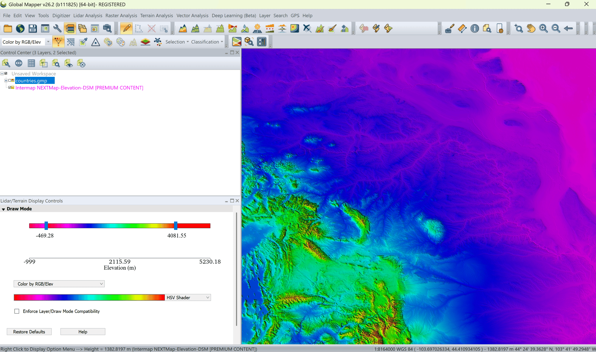
Intermap and Blue Marble provide seamless access to NEXTMap® elevation data through Global Mapper.
Perform Detailed Terrain Analysis
Generate contours, evaluate slope and aspect, analyze terrain characteristics and support engineering workflows.
Access DTM & DSM Products
Leverage authoritative Digital Terrain Models and Digital Surface Models through a familiar GIS environment.
Continually Updated Data
Access a continually updated 3D data foundation that incorporates enhancements and new information over time.
Simple Subscription Access
Deploy high-quality terrain intelligence quickly through flexible subscription options.

Solar Farm Site Assessment
Intermap's 3D data and terrain intelligence help renewable energy developers better understand site conditions, environmental constraints and project feasibility.
In the southern French Alps, NEXTMap data was used to evaluate terrain and environmental factors associated with solar park development, helping stakeholders make more informed decisions regarding project planning and land use.
From site selection and feasibility studies to infrastructure planning and environmental assessment, Intermap provides the trusted 3D data, terrain intelligence and geospatial analytics needed to accelerate renewable energy development worldwide.
RENEWABLE ENERGY SOLUTIONS
Learn how Intermap supports renewable energy planning with elevation data, slope, aspect, canopy height and geospatial intelligence for site selection, accessibility, infrastructure planning and project development.
Elevation data helps renewable energy developers evaluate accessibility, slope, aspect, drainage and other site conditions during site selection, planning and development.
Elevation data helps identify terrain conditions, slope, aspect and surrounding land characteristics that may affect solar project suitability, accessibility and development.
Elevation data supports site exploration, analysis of terrain features which impact wind flow, road planning and infrastructure development for wind energy projects.
Slope measures how steep the terrain is, while aspect identifies the direction a slope faces; understanding both helps developers evaluate site suitability and project design.
Yes. Elevation, slope, aspect, land characteristics and other geospatial information can help developers screen large areas and identify locations with the highest energy output potential.
Yes. Intermap provides elevation and geospatial data across regional, national and global areas to support renewable energy projects from initial site exploration through the detailed planning stages of a project.
Connect with our team to learn how Intermap can support your mission.

